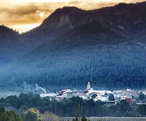
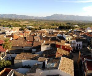
La Vall D'Albaida
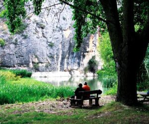
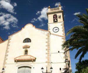
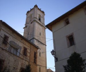
The Arabs called it Vall Blanca because of the colour of the land. The region is made up of 34 towns nestled in a beautiful area of mountain ranges, including the Benicadell, the Serra d’Agullent and the Serra Mariola. These mountains provide splendid views and shady areas full of aromatic plants. The town of Bocairent is especially striking, and its Medieval Quarter is declared a Historic-Artistic Site. It is one of the architectural jewels of the Province, as well as its bullring, the oldest in the Comunitat Valènciana, its museums, its enigmatic Covetes dels Moros (National Historic-Artistic Monument), the Cava de Sant Blai (16th century) and its natural heritage, of which the Serra Mariola Natural Park should be highlighted. Albaida, has a historical complex formed by the Church of the Assumption and the Palau del Marquesat d’Albaida, along with its two museums: the International Museum of Titelles (unique in the world) and the House-Museum of the painter Segrelles, as well as Ontinyent (the regional capital), the main textile production centre of the Comunitat Valènciana, of which the neighbourhood of La Vila and the Church of Santa María (with its extraordinary bell tower), its many palaces and its museums, make this a very attractive region for tourists.
Municipalities
-
Agullent
Agullent is unique, as its location offering all the charm of living at the foot of the mountains, enveloped in the scent of thyme. It has 2364 inhabitants and two festivities that have been declared of Valencia Regional Local Tourist Interest, these being the Moors and Christians festivities (held the week following Easter) and “La Noche de las Hogueras y Fiestas del Milgaro (The night of bonfires and the festivities of the miracle), held at the beginning of September. Aguillent has also been declared a Municipality of Tourist Interest. The production of traditional sausages, candles and the balls used in the Valencian game of “pelota” are some of the artisan activities that have survived from the past. There is a striking architectural legacy that can be evidenced in many areas of the municipality, such as “Fornet de la Neu”, “Los Lavadores”, the Convent of Saint Hyacinth, the Hermitage of Saint Vicent Ferrer, the church of Saint Bartholomew and the “Font Jordana” Park. It lies 5 km from Ontinyent, the capital of the administrative region, and less than an hour from Valencia.
-
Aielo de Malferit
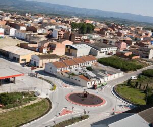
Aielo de Malferit is located at 281 m above sea level in the south of the province of Valencia, in the north-east of La Valle d’Albaida administrative region. Its municipality is surrounded by mountains: the “Serra Grossa” range to the north, “La Solana” to the west, “l’Ombria” and “La Serratella” to the south. Its municipal term limits with those of Vallada, Montesa, Canals, l’Olleria, Albaida, Agullent and Ontinyent. Aielo de Malferit is a quiet village with a population of 4,700 inhabitants, which increases during holiday periods due to the influx of visitors who opt to relax in the municipality and enjoy its heritage, its festivities and, especially, its natural surroundings.
-
Aielo de Rugat
This agricultural village is located on the northern slopes of the Sierra del Benicadell range. It belongs to the administrative region of La Vall d’Albaida.
-
Albaida
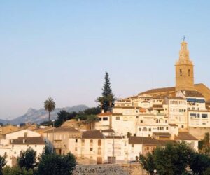
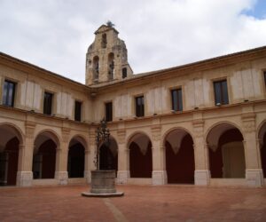
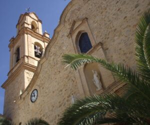
Albaida is located at the foot of Albaida Pass and a short distance from the Sierra del Benicadell range. Its name comes from the Arabic “Al-Bayda”, which means “The White”, in all probably named for the colour of the land found throughout most of the administrative region. The city was named as such in 1906 by King Alfonso XIII and declared a tourist attraction in 2002, by virtue of its interesting historical, artistic and museum heritage.
-
Alfarrasí
–
-
Atzeneta D´Albaida
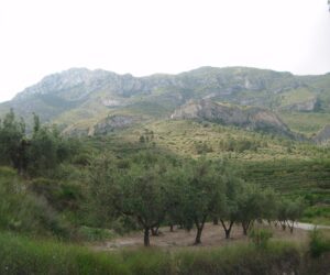
As stated in the book “El Mirador del Valle. Patrimonio historico-artístico y tradición artesanal de Atzeneta d’Albaida”, published by Atzeneta Council in 2002, the unique pictorial beauty of this town, known among the people of the administrative region as “the Valley Viewpoint”, is due fundamentally to the conjunction of two landscape features. One is the limestone mountains, full of pine trees, which has provided water and stone, snow and wood, grass and honey, to the inhabitants of the Marquisate of Albaida: the Sierra de Atzeneta range. The other scenic and heritage element is the village itself, together with its people.
-
Bèlgida
Located on the northern slopes of the Sierra de Benicadell range. The climate is mild. There is a predominance of dryland crops: grapes, olives and carob. Industrial activity is derived from agriculture: oil mills, wineries.
-
Bellús
The municipality of Bellus is located in the southeastern foothills of the “Serra Grossa” range, in the north of the “Vall d’Albaida” administrative region. It borders with the municipalities of Benigánim, Guadasséquies, Xativa, l’Olleria and Sempere. The local terrain is slightly undulating, except for its northern part, where it reaches an altitude of about 400 m. above sea level. The most significant local peaks are “Tossal del Caldero” (298 m.) and “Paller” (392 m.). Bellus has a population of around 373 inhabitants. Its economy is based on traditional agriculture. Almond trees, vines and olive trees are grown in the dryland areas. Vegetables are grown on the irrigated land.
-
Beniatjar
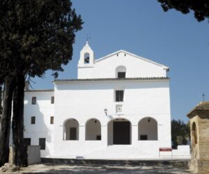
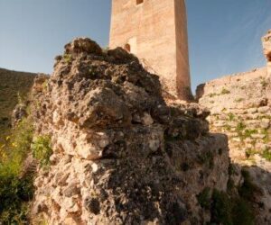
A municipality located on the northern slope of the Sierra de Benicadell range, in the southern sector of La Valle de Albaida. The municipality is long, stretching from north to south: the northern sector is gently undulating, while the southern sector borders with the Benicadell mountains. The River Micena flows from east to west along the entire northern limit; it is fed by the Beniatjar ravine, which represents the western limit. The climate is continental; the most frequent winds are “ponent” (east) and “llevant” (west). The later is responsible for bringing rain, usually between autumn and spring. It often snows in the Sierra de Benicadell mountains in January and February. The local economy is based on agriculture, with terraced fields in the foothills of the mountains. In the mountains there is a vast area of private and state-owned pine forest and scrubland. There is a predominance of dryland crops, such as grapes, cereals and olives. Small irrigation reservoirs, fed with water from various springs, are used for the cultivation of potatoes, maize and vegetables. The village is located on a hill at the foot of the Benicadell peak. The church is dedicated to Our Lady of the Incarnation; it has two panels attributed to Joan of Joanes. Carbonera Castle lies within the municipality. There is a former snow storage construction on the ridge of the Benicadell.
-
Benicolet
Located in the eastern sector of Vall d’Albaida. The municipality’s terrain is hilly and mountainous. The main peaks are “Loma Alta” (449 m.), “Loma Requena” (353 m.) and “Cantal del Cazador”. The village is located on a plain, on the right bank of River Vernissa and at the foot of a hill. The climate is temperate, with cold winters; the prevailing winds blow from the east and west; the former is responsible for bringing rain, usually in autumn and winter.
-
Benigànim
.
-
Benissoda
Located in the southwest of Vall d’Albaida, on the northern slopes of the Sierra de Agullent range. The municipality’s terrain is hilly, with peaks of less than 500m. The most significant mountains are: “Llombo”, “Bon Aire” and “Vista Bella”. The “Baladrar” and “Benissoda” ravines run through the municipality, and there is a small reservoir for regulating irrigation. The village is located on a hill, next to the road. The climate is temperate, with cold winters; the prevailing winds blow from the east and north; the former is responsible for bringing rain, usually from December to February.
-
Benissuera
A small village focussed mainly on agriculture and located on the left bank of the River Albaida. The main local crop is grape. The tranquillity of village life and the warmth of its people are the most notable aspects of the municipality.
-
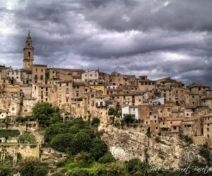
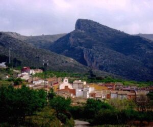
Bocairent
Bocairent is one of the most picturesque towns in the province of Valencia and the Valencia Region. Its importance throughout history is evident in its monuments and its heritage. When we talk about Bocairent, we speak of “the town where the stones speak.”
-
Bufali
The oldest information about Bufali dates from the time of Arab domination, when the kingdom was conquered by King James I of Aragon. That it was an Arabic hamlet is evidenced by its name, Bufali. According to Sanchis Sivera (“Geographic-Statistical Nomenclature of the people of the Diocese of Valencia”, Valencia 1922), the Arabs called the village “Bohali”.
-

Carrícola
Carrícola is located in the eastern extreme of Vall d’Albaida, on the northern slopes of the Sierra de Benicadell range. The municipality consists of two distinct sectors: a plain to the north and the area to the south, cut through by the hills of the Sierra de Benicadell range. The land is calcareous. The weather is warm.
-

Castelló de Rugat
Castello de Rugat is located in the eastern extreme of Vall d’Albaida, on the northern slopes of the Sierra de Benicadell range. It is located at an average altitude of 320 m. It has a chain of mountains that separate it from the south of the Comtat administrative region, most notably the Sierra del Benicadell range. To the north, east and west, there is a flat, dryland area populated with a multitude of ravines.
-
El Palomar
El Palomar is a municipality located in the centre of the Vall d’Albaida administrative region. It extends to the Serra de l’Ombria Natural Park and the Sierra del Benicadell range. The visitor can entertain him/herself by discovering every corner of the village, walking around the surroundings and natural spaces and enjoying the warmth and hospitality of the residents.
-
Fontanars dels Alforins
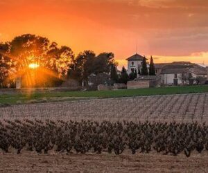
Fontanars dels Alforins is located on the highest lands in the eastern part of Vall d’Albaida. The plateau of “los Alforins”, bordered by the Serra Grossa and the Serra de Beneixama ranges, set in a mosaic landscape combines vineyards with olive and cereal crops. The local earth is a mixture of sand and clay banks, forming one of the most beautiful sediments to be found in Spain, providing a unique set of conditions for the practice of agriculture. The Mediterranean climate begins its transition to the continental climate and the landscape surprises the visitor during all periods throughout the year. The newer centre of Fontanars dels Alforins cohabits with numerous fields, wineries, holms oak forests, and stately mansions surrounded by pine trees. Els Alforins were incorporated into the Kingdom of Valencia in 1245 by the troops of James I of Aragon, and depended on the town of Ontinyent until 1927.
-

Guadassèquies
–
-
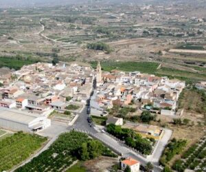
L´Olleria
L’Olleria is a village of 9000 inhabitants, situated within the province of Valencia, in the administrative region of “Vall d’Albaida”. Located 75 km from the city of Valencia and 103 km from the city of Alicante, l’Olleria is located between Alcoy, Ontinyent, Xàtiva and Gandia. L’Olleria is situated at the foot of the Sierra Grossa range, surrounded by the Grau and Puerto ravines. The municipality, which is crossed by the River Clariano, is characterised by its agricultural fields: vineyards, olives, carobs, almond and fruit trees and aromatic plants. The vegetation benefits from the dry Mediterranean climate. It is a village with a long traditional of craftwork. Throughout history, the people of L’Olleria have been dedicated to the production of oil and wine, traditional handicrafts and trade.
-
La Pobla del Duc
It is located on the right bank of the River Albaida . The climate is Mediterranean. From Valencia , the village is accessed via the A-7 , followed by the CV-40 , the CV-60 and the CV-611 . The village can also be reached by the Renfe Medium Distance line 47 , also known as the Valencia-Xàtiva-Alcoi line.
-
Llutxent
Llutxent is located in the middle of the Valencia Region, in the east of the administrative region of Vall d’Albaida. It lies 13 kilometres from Xàtiva and 24 from Gandia. The C-322 road crosses the village. The municipality covers an area of 39.1 kilometres and is bounded on the north by Pinet; on the east by Gandia, Rótova Ador and Almiserà; on the south by Benicolet, Castelló de Rugat and Pobla del Duc; and on the south by Quatretonda. The nucleus of the village is located at 284 metres above sea level.
-
Montaverner
–
-
Montitxelvo
The beautiful landscape, the absence of traffic and a multitude of routes make Montitxelvo a perfect location for hiking and cycling. The “La Creueta” SL-CV83 and “La Ruta de l’Aigua” SL-CV84 hiking trails have recently been homologated.
-
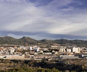
Ontinyent
The presence of the textile industry has marked the appearance and given personality to the capital of the administrative region of the Vall d’Albaida. The metamorphosis of an agricultural society with industrial presence into a fully-industrialised society took place in the 1950s. The life of the city has always depended on water, and the abundance of surrounding springs. Ontinyent, as a demographic entity, is explained mainly by the existence of its extensive agricultural land, one of the ten most important agricultural areas in Valencia. The abundance of water and the use of the local waterfalls for energy explain the formidable concentration of manufacturing and fulling mills, as well as wool and paper plants, dating from the 18th century.
-
Otos
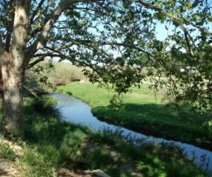
In the shade of the Benicadell range, we find the village of Otos, which extends as a narrow, elongated shape perpendicular to the mountain in a northerly-southerly direction. Its maximum altitude (1022 m.) is registered at “Alto del Morral”, or “Collao”, a point which serves as the administrative boundary for a total of four municipalities. The lowest point today is around 140 m. above sea level, in a location that is fairly removed from the village centre: the beautiful centre of “Valle Blanco”, where the River Albaida caresses the village of Benisuera and receives the tributary waters of the River (nowadays an overflow area of the Bellus Reservoir).
-
Pinet
A municipality located in the administrative region of La Vall d’Albaida, set in a circular valley. The River Piner collects water from the mountains that enclosure, flowing into the River Vernissa to the south. The centre of Pinet is small. The village is located at 347 metres above sea level, and the municipality covers an area of 11.68 km. It borders with the municipalities of Barx, Gandia, Llutxent and Quatretonda.
-
Quatretonda
Population: 2468 inhabitants. Municipal term: 43 km Altitude: 224m. Name: quatretondà, quatretondana.
-
Rafol de Salem
The village is located in the northern foothills of the Sierra del Benicadell range. The municipality covers a small area. The climate is Mediterranean, with slight continental characteristics.
-
Rugat
–
-
Salem
Salem, which is located in the Valencia administrative region of Vall d’Albaida, has about 500 inhabitants and is set in a mountain-enclosed valley which opens onto the area known as “La Ombria” in the Sierra de Benicadell range. La Hoya de Salem stands between 350 and 300 meters above sea level.
-
Sempere
Sempere is the smallest population (in number of inhabitants) of the region of Vall d’Albaida. The village stands out for the tranquillity of its streets and the friendliness of its people, as well as the custom among the older women to make fishing nets using traditional techniques.
-
Terrateig
The terrain has a slight undulation that descends from its southern extreme, where the 579 metre peak of Sant Jaume is located, to the bed of the River Vernissa. The northern part of the municipality is occupied by farmland. The climate is typical of Mediterranean countries, with average temperatures ranging between 9º in January and 24º in July and August.

