L'Horta
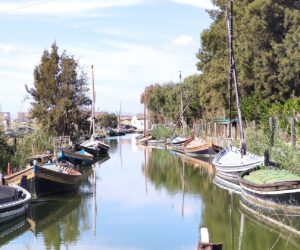
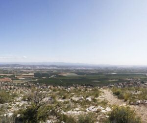
This is the most populated region, where the city of València is located and part of the Albufera National Park. An important industrial and service centre, among its heritage is the city of Manises, a very important ceramic centre, samples of which can be seen in the Ceramics Museum; the Monastery of Santa María del Puig, Los Silos de Burjassot, and the Muslim Towers of Paterna and Torrent. In addition, the beaches of Alboraya, La Pobla de Farnals, El Puig de Santa Maria, Puçol and València, are a top tourist attraction.
Municipalities
-
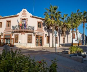
Alaquàs
Located just 7 km from Valencia, Alaquás has approximately 28,000 inhabitants. The municipality is flat and almost completely developed. The local economy is based on construction and industry.
-
Albal
Albal is located between the Albufera Natural Park and the final slopes of the Sierra Perenchiza range, some 8 km from Valencia. The village has a population of about 15,600 inhabitants, and is mainly focussed on agriculture (rice, orange, tangerines and vegetables), small industry, furniture making and the services sector.
-
Albalat dels Sorells
Albalat dels Sorells is a municipality located on the coast of the administrative region of l’Horta Nord. It lies just 3.25 km from the beach and 7.37 km north of Valencia. The village has a population of about 3,900 inhabitants.
-
Alboraya
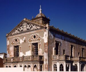
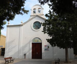
A typical municipality located in the Valencian agricultural land, which is still populated by “barracas” (local agricultural houses) and “alquerías” (farmhouses), with notable examples including “l’alqueria del Magistre” and “San Andrés”, as well as the Gamba mill. The Hermitages of Saint Barbara, Milagro and Vilanova, baroque, which contains the old effigy of Saint Christopher Martyr, the patron saint of Alboraya, an which was discovered in 1442. Beaches and Port-Saplaya residential development, on the coast. Its religious buildings include the Parish Church of the Assumption of Our Lady, dating from 18th century. It is a religious building of baroque style and medieval origin. It has three naves with side chapels between buttresses. The central nave is notable for its pointed barrel vault.
-
Albuixech
Albuixech is a coastal village located in the administrative region of l’Horta Nord, 10 km from Valencia. It has about 1 km of low and sandy coast, which is 2 km from the village. Traditionally based on agriculture, today it is mainly an industrial and services village.
-

Alcasser
The municipality of Alcàsser is flat and is located 30 m above sea level. It lies only 13 km from Valencia. The village has a population of about 9,000 inhabitants, and the local economy is mainly focussed on agriculture and industry.
-
Aldaia
The municipality of Aldaia is located in the western metropolitan area of Valencia. The Madrid-Valencia railway crosses part of the village, which lies very near Alaquàs. It has a population of about 30,000 inhabitants and is located 8 km from Valencia.
-
Alfafar
The village has a population of about 21,000 inhabitants. It lies only 6 km south of Valencia, at an altitude of 6 m above the sea level. A large part of the municipality lies within the Albufera Natural Park and is occupied by rice fields.
-
Alfara del Patriarca
A Muslim farmstead reconquered by James I in 1249. The municipality is completely flat, with the exception of the Carraixet ravine, which crosses it from north to south. The Royal Moncada Irrigation Canal also crosses the municipality. The adjacent municipalities are Foios, Moncada, Vinalesa and the districts of Carpesa and Benifaraig.
-
Benetússer
A municipality belonging to the L’Horta Sud administrative region, it lies some 5 kilometres from the city of Valencia. The plain is irrigated by the different arms of the Favara irrigation canal which crosses below the village centre (now completely built-up) and runs into the Albufera Lake. The municipality is certainly small, measuring hardly one kilometre square, a factor that conditioned the transition in the past from agricultural to industrial activities. Its historic location on the “Camino Real de Xativa”, or the Valencia to Madrid Royal Road (today “Avenida del Camí Nou), has been a great advantage to Benetússer, providing good accesses and communications by road and rail. This circumstance enabled the village to progress and to modernize itself during the last century until becoming the small dynamic town it is today, equipped with all the services necessary. Industry has gradually given way to commerce and services of all kinds, which currently provide employment for a large part of the workforce.
-

Beniparrell
Beniparrell is known for the production of flowers and plants, as well as for its furniture industry. It is located 9 km from Valencia.
-

Bonrepós i Mirambell
The municipality is formed of two centres: Bonrepós y Mirambell. It is completely flat, with a slight slope running northwest to southeast, without any significant geographical features, with the exception of the Carraixet ravine in the municipality’s southern and western limits. It is located 5.7 km from Valencia.
-
Burjassot
Located on the western edge of l’Horta Nord, in the metropolitan area of Valencia. The municipality is composed of two areas: the eastern “levante” zone, formed of agricultural lands, irrigation canals and crops; and the western zone, which is higher and is formed of limestone hills.
-
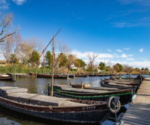
Catarroja
Catarroja is located in l’Horta Sud, 8 km from Valencia, on the banks of the Albufera Lake. Its landscape is characterized by its agricultural lands and the surrounding wetland, where boats, rice and the port shape its essence. The village has been traditionally dedicated to fishing and the cultivation of rice, although there is also a strong furniture industry.
-
Emperador
Emperador is a small municipality which is completely flat and surrounded by the municipality of Museros.
-

Foios
The municipality of Foios is has an elongated shape, running from east to west, from the mountains on the periphery of La Huerta Norte to the Mediterranean Sea. Its maximum altitude is 64 m above sea level, descending smoothly without any notable features.
-
Godella
Godella is a municipality located in the administrative region of La Huerta Norte, some 4.8 km to the north east of the city of Valencia. It covers an area of 8.4 km2 and is located at an altitude of 33 metres above sea level. It borders with the administrative regions of, to the north, Bétera and Rocafort, to the east, Valencia, to the west, Bétera and Paterna, and to the south, Paterna and Burjassot. “Los Frailes” ravine is the most significant geographical landmark. As there are no springs, drinking water is obtained from wells. The climate is Mediterranean, with mild winters and hot summers. The rains are present mainly in spring and autumn. The municipality is crossed by the Burjassot-Torres Torres road and the Valencia-Bétera light railway.
-
La Pobla de Farnals
La Pobla de Farnals is a municipality of l’Horta Nord, located 13.3 km from Valencia. The village has a population of about 7,400 inhabitants. The municipality has traditionally been dedicated to agriculture, although there is now a large industrial and, above all, tourism presence.
-
Llocnou de la Corona
A municipality located south of the city of Valencia, on flat ground. The municipality is the smallest of the province and is limited to the village centre. The current village originated from a convent that was founded in 1676. Over the years, it was abandoned and agricultural workers’ houses sprung up in the surrounding area. This residential area came to be known as La Corona. The current church, completed in 1902 on the site of the old chapel, is dedicated to Our Lady of the Rosary. The main festivities are held on the day of Corpus Christi. Its inhabitants are called “llocnouïns”.
-

Manises
Manises has a population of about 30,000 inhabitants. It is located within the metropolitan area of Valencia, just 7 km from the centre. The village stands out for its ceramics industry, which produces items in a multitude of styles and using many different new techniques, whilst simultaneously conserving it traditional processes. The antiquity of Manises has been demonstrated by the discovery of Roman remains in “Partida del Racó” and “Masía la Cova”, such as lamps, weights, pieces of amphora, housing walls, pottery stamps, etc., and the existence of an aqueduct that still conserves over twenty arches. The aqueduct is undoubtedly Roman, although it usually attributed to the Arabs. The origin of the village is Muslim, although there are remains from Roman times. The Muslims created a major ceramic centre that was donated by James I in 1237, following the conquest of the city, to the family of Artal de Luna, one of the trusted men who accompanied him during the Valencian campaign. However, on 3rd December, 1304, the manor was definitively incorporated into the possessions of the Boïl family, who maintained ownership until the abolition of manorialism in Spain. The memory of this period figures in the Boil family crest, officially adopted by the Town Council as a representative emblem of the village. Between the 14th and 16th centuries, tiles with a metallic, reflective finish, together with those decorated with blue tones, brought Manises fame throughout Europe and were sought after by princes and popes, and praised by numerous testimonies of the time. From 17th to 19th centuries, this production of decorative and utilitarian objects, in a clear process of decline driven by changing tastes and fashions, was augmented with the introduction of polychrome tiles decorated with vivid and imaginative motifs, which in turn were used as decorative articles, symbolic items and building elements, and which gave new impetus to local production. Manises’ ceramic industry employs a multitude of styles and techniques which include the latest technological advances, without forgetting the traditional ceramics processes that are testimony to the artisan culture that the village has preserved.
-
Massalfassar
The village of Massalfassar is located next to the Mediterranean Sea, 12 km north of Valencia. It includes the Rafalet and Vistabella neighbourhoods. The terrain is completely flat, and located at 9 m above sea level. Massalfassar’s most important building is the Parish Church of Saint Lawrence the Martyr. It dates from 17th century and was constructed in a markedly Churrigueresque style. There was formerly a mosque in the nearby area. Mention may be made of its style, its stained glass windows and its altarpiece, which has been subject to various restoration processes. It contains an effigy of Our Lady of the Forsaken and the Immaculate Conception. It is currently in a very good condition.
-
Massamagrell
Massamagrell is a municipality located in l’Horta Nord. It lies some 12 km from Valencia at an average altitude of 15 m above sea level. The local agricultural land is mostly dedicated to irrigation crops, and produces excellent oranges, fruit and vegetables.
-
Meliana
Meliana is a coastal municipality, to the north of the city of Valencia. Its natural surroundings, the agricultural land, represent the area’s main asset, enriching both its commercial life and its cuisine. “La Fuente de San Antonio”, which can be found in the Roca neighbourhood, is the only hydrographic accident. It has an approximate population of 11000 inhabitants.
-
Mislata
Mislata is, with more than 42,000 inhabitants, one of the most populated municipalities of the administrative region. It is located 2.3 km from Valencia to the west, at an average altitude of 29 m above sea level. The cross marking the limit of the municipality, dating from 15th century, divides the municipalities of Valencia and Mislata. Mention may also be made of the beautiful Town Hall, located in the old town. A relaxing stroll through the large park located next to the sports centre is highly recommended. The Church of Our Lady of the Angels is the oldest in Mislata (18th century) and displays a succession of styles and extreme simplicity, especially on its façade. It was constructed on one level and has a Latin cross layout and a barrel vault. In addition to the Church of Our Lady of the Angels, there are two more churches in Mislata: the Church of Saint Francis of Assisi and the Church of Saint Michael of Soternes. The Convent of Our Lady at the Foot of the Cross dates from the mid-20th century and is located near to the Church of the Angels. It is contemporary in style and has a single nave.
-
Museros
The municipality of Museros lies 10 km from Valencia, 17 km from Sagunto and only 4 km from the Mediterranean coast. The municipality is flat and located at an altitude of 21 m above sea level. www.ajunt-museros.com
-
Paiporta
Paiporta lies 5.5 km from the centre of Valencia and has a population of about 23,600 inhabitants. Its flat surface has traditionally been dedicated to agriculture. Its main geographical feature is the Torrent, or Chiva, ravine, which flows into the Albufera Lake.
-

Paterna
In just a few years, Paterna has ceased to be a town devoted almost exclusively to farming to become a residential, industrial and service centre. Thus, the original population has been joined by new inhabitants from other areas.
-
Picanya
Picanya is a municipality in l’Horta Oest located 5 km from Valencia and 2 km from Torrent, with productive agriculture and progressive industrial development, located in the Valencia metropolitan area. It currently has a population of over 11,000 inhabitants.
-
Picassent
Picassent is a Valencian municipality located in the administrative region of L’Horta Sud. It forms part of the Valencian metropolitan area, and lies 17 km from the city of Valencia. It has a population of about 20,000 inhabitants and is located at an altitude of 50 m above sea level.
-
Quart de Poblet
Quart de Poblet is located in the administrative region of l’Horta Sud, 5.9 km from Valencia. The municipality is completely flat, and is crossed by the River Turia to the north. It has approximately 25,500 inhabitants.
-
Rafelbunyol
Rafelbunyol is a village near to the Sierra Calderona range, located in the northern part of the administrative region of l’Horta. Moncada Irrigation Canal divides the municipality in two. To the right lies “l’Horta”, and to the left the traditional drylands, which have been transformed into irrigation land.
-
Rocafort
Rocafort is a municipality that is essentially dedicated to the tertiary sector. The village has a population of about 6,700 inhabitants. It is located at an altitude of 35 m above sea level.
-

Sedaví
Known as one of the main producers of furniture in our province, the municipality of Sedaví is located south of the city of Valencia, in the administrative region of l’Horta Sud. It is located at 9 metres above sea level and is mostly flat. The village has a population of about 9,900 inhabitants.
-
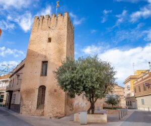
Silla
The village lies 12 km from Valencia, at an average altitude of 8 m above sea level: two geographic factors that have influenced the evolution of Silla. On the one hand, the characteristics of the weather and the productive land and, on the other, its privileged situation between a crossroads and its proximity to the Albufera Lake. TOURIST INTEREST The 18th century Church of Our Lady of the Angels (the façade of which has been recently lit) is the village’s most prominent monument. A perfectly preserved Muslim tower, which is attached to the Town Hall, is the village’s most prominent civil monument. This tower formed part of a Muslim castle that used to stand in Silla. Only the defence tower remains: together with others such as the Espioca and Benifaió towers, formed a defensive ring around the city of Valencia. Mas de Baix, and the Albufera port, are the most important and interesting natural sites.
-

Tavernes Blanques
Tavernes Blanques is located 2.8 km north of Valencia. The village has a population of about 9,400 inhabitants.
-
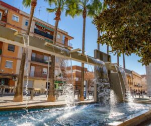
Torrent
Make Torrent known as the center of the Valencian Community with its cultural, natural and gastronomic resources.
-

València
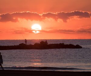
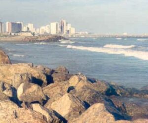
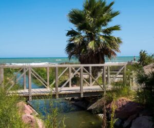
Beaches and green spaces, monuments and neighborhoods that narrate its history and heritage, a spectacular hotel offer, iconic spaces dedicated to design and architecture (in fact it will be the World Design Capital in 2022), and an inexhaustible gastronomic offer that travels between tradition and the avant-garde. Perellonet-Recatí Beach, La Garrofera Beach, EL Saler Beach, Arbre del Gos Beach, Pinedo Beach, Cabañal Beach, Malvarrosa Beach
-

Vinalesa
Vinalesa is a municipality with a wide range of services and sporting and cultural activities. It is an active village, with a population of about 3,200 inhabitants. The terrain is flat with a gentle slope from NW to SE. It is located at an altitude of 21 m above sea level. TOURIST INTEREST Vinalesa’s heritage includes the Church of Saint Honoratus (18th century). Gothic. Mention may also be made of Vinalesa’ old silk factory, dating from the 18th century. When in operation, it pioneered the introduction of new techniques for the treatment and manufacturing of silk. It has been renovated by the town council and is used as a civic centre. In its new life, it has become the authentic nerve centre of the village.
-

Xirivella
Our village is located on the fertile land of “Pla de Quart”, between the River Turia and the Chiva ravine. Xirivella is a municipality of more than 31,000 inhabitants that is lies adjacent to the city of Valencia, separated only by the new River Turia riverbed. In fact, one of its neighbourhoods, “La Luz”, was located in the capital on the left bank of the river following the implementation of the “Plan Sur” project.

